We have relatively accurate information on the location of the castle and the town as a whole. The castle occupies the entirety of the current church square. Some rare elements still remain: the Griffon tower emblematic symbol of the city, the square tower whose foundations are still visible at the Institute Saint-Michel and the curtain along the pool of the institute. Another part was discovered in the East and rebuilt during the last two decades. All known parts are indicated in yellow in the following figure (Fig. 15) . The book of Messrs. Geubel and Gourdet is of great precision in this respect: they drew up the plan fifty years before!
The rest of the layout (indicated in red) is a reading of the Arenberg map (1609) inspired by the current structure of the city.
The castle on its rocky outcrop is accessible for the attacker only via the "Lombard", the rest of the periphery being too steep. This "Lombard" (seen in detail later) is located on the site of Dr. Simeon's home. Its location is known but its orientation is subject to debate: perpendicular to the front of the castle according to Messrs Geubel and Gourdet, the option is rather here to align it with this one and estimate its entry to the location of the home of Mr Roger Laurent.
The city wall follows the Rue des Fossés (which probably originates from the name) to the Porte Neuve at the junction with Franklin Roosevelt street to go up to the place of the courthouse and then go down over "Rue des Jardins", from the top of "Rue des Oies" and finally reach the city gate below the city hall (in front of the athénée). The perimeter is about 550 m. The rampart crowned the escarpment to the north and east. Towards the Terme and the Faubourg, he dominated the natural slope. He reached the height of the houses, was not crenellated but pierced at the top of a row of archers. The low towers were semi-circular.
Note the gap between the upper courtyard and the lower courtyard inside the castle. Escarpe and counter-escape crossed the current church (Ref. [2]).
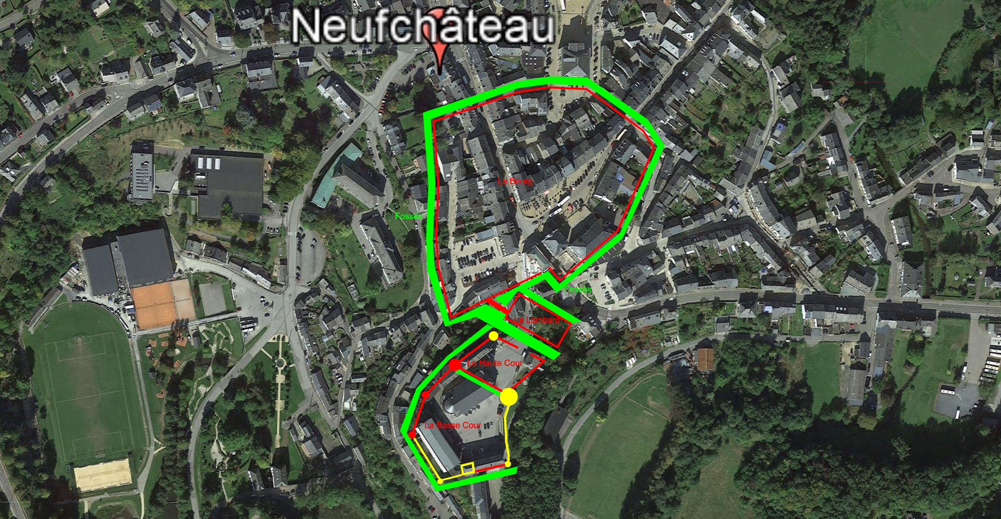 |
| Fig.15 - The castle and the village in the Middle Ages Source : Google map ® |
Medieval fortification obeys some major guidelines. Ref.[8].
- Powerful fortresses (with towers more than 15 m in diameter connected by curtain walls) whose origins date back to the time of Philippe Auguste
- The defender dominates the attacker.
- In-depth staggering of the various obstacles that make the approach more difficult (advanced structures such as Lombard, ditches, palisades, walls, high and low court, etc.) (Fig. 15) .
- Sideways flanking or from the top by wooden galleries (hourds) or stone (machicoulis)
- Breteches that can cover a specific point (for example, a door).
- The defenses can be passive (almost impassable obstacles, very thick walls ...) or active (archers, cannonières, hours, machicolation, as well as the lines obliging the enemy to expose themselves)
- The wooden towers on a mound of earth surrounded by palisades succeed the Roman dungeons (XII th century), rectangular buildings which inspired the Square Tower of our castle.
- Walkway behind the top of the walls
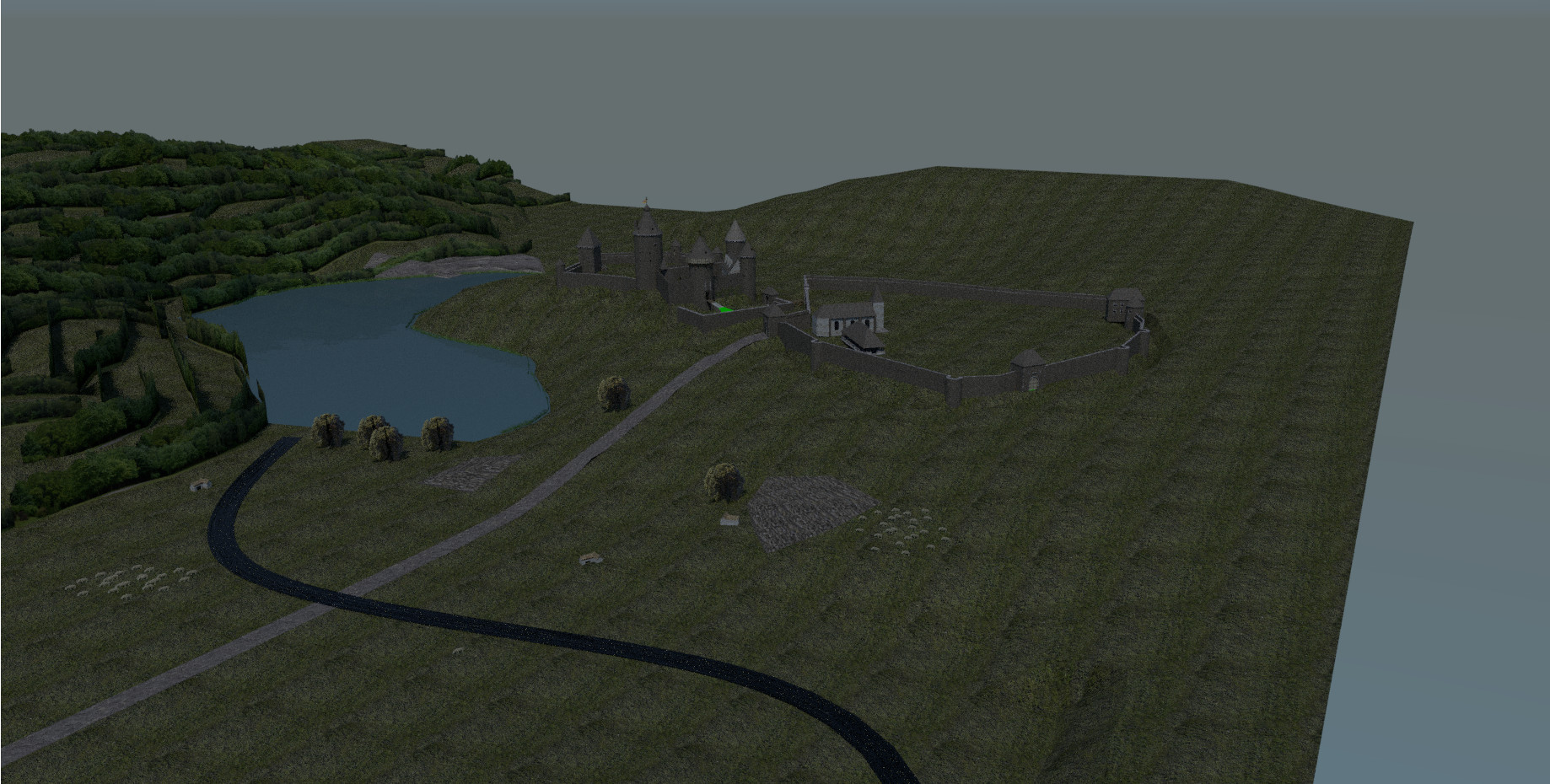
All these great principles of medieval architecture will be reviewed in detail in 3D reconstruction to guide us in reading and interpreting the map of Arenberg. It will be in the next step to build step by step the 3D model below and justify the approach and its assumptions (Fig. 16).
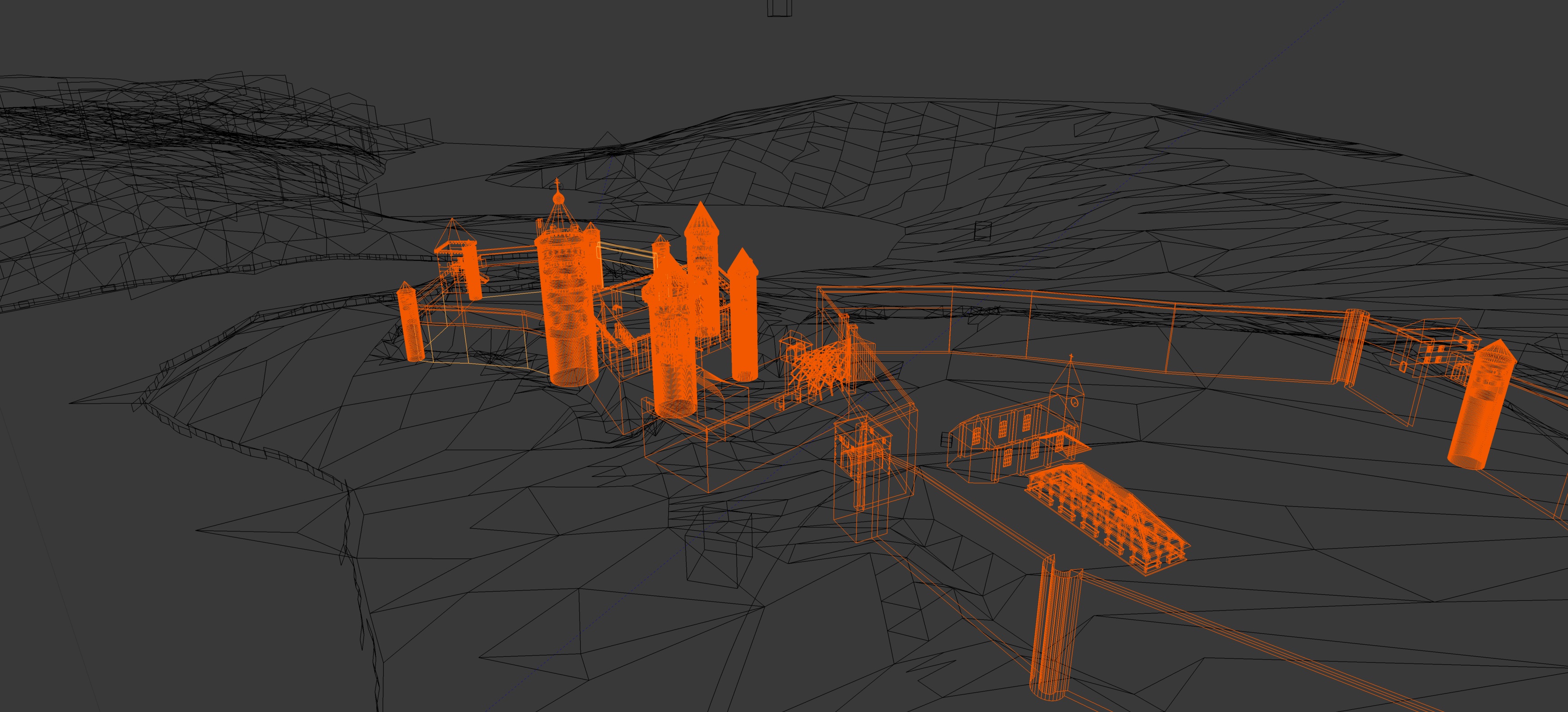 |
| Fig.16 - Neufchâteau in the Middle Ages - 3D partial model Source : Blender model of the author |
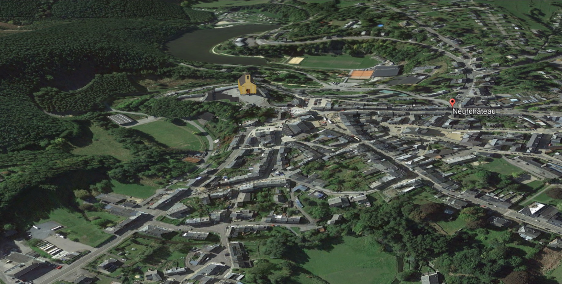
A first interesting preview is an overview of the city today with Google Earth © compared to what it could have been in the Middle Ages to the XV century (Fig. 17) . This virtual projection in the past gives a first impression of the castle and the town with a much smaller occupied space than the city today. The village was limited to the city center. Other areas such as the Terme or the Faubourg do not appear yet. The pond in the valley upstream of the common mill is now gone. It is all this 3D modeling that we will review with the various elements more or less known that constitute it.
(Swing the mouse "in" and "out" on the next image to see the comparison)